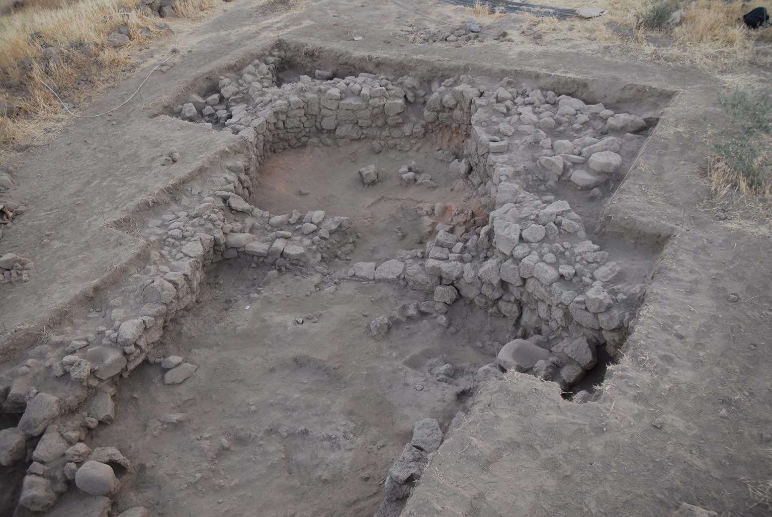
Due to a fire incident the roof construction of the early PPNB building found in Squares Y/Z-67/68 was well preserved (Balbo et al. 2012). After the abandonment, the building was used as a burial place (Ibáñez et al. 2010) (Photo: Luis Teira).
The prehistoric settlements around the paleolake of Qarassa, southwest Syria, were discovered during surveys in the frame of the projct of the "Altas archéologique des sites pré- et protohistoriques de la Syrie du Sud" directed by Michel Al-Maqdissi (DGAM, Syria), Frank Breamer and Christophe Nicolle (CNRS, France) (Ibáñez et al. 2012:9). [1]
PPNB:
Tell Qarassa North was first sounded by C. Nicolle in 2007 by the Syrian-French Archaeological Mission directed by Frank Braemer (CNRS). Some architectural remains dating to the early PPNB and a primary burial were discovered then. Between 2009 and 2010 the excavations were continued by a Spanish team directed by J.J. Ibáñez, as part of a collaborative project with the Syrian-French Mission (Ibáñez et al. 2010).
Two zones (1 and 2) were excavated. Zone 1 comprises the areas (Squares X/Y/Z 65-69=79m²) and (Squares U/V-67=12m²) (Ibáñez et al. 2014).
In Zone 2 (Squares JKLMN/ 41-42), a trench was excavated across the mound in order to determine the stratigraphy. Two architectural layers were discovered. In the lower layer a cache of 11 isolated skulls was discovered, which were deposited in two groups of 5 and 6 skulls respectively (Santana 2012:206-207).
In Zone 1, two main occupational phases of the PPNB were identified. "The earlier phase of occupation has been dated to the mid ninth millenium BC (8740-8350 calBC [...]) and falls within the Early PPNB. The later level of occupation has been dated to the second half of the ninth millenium BC (8310-8020 cal BC [...]), at the transition between the Early and Middle PPNB." (Ibañez et al. 2014:82-83).
Interestingly, the buildings of area Y/X/Z were abandoned and reused in the later phase as a burial place. This is in contrast to other earlier and contemporary PPN sites, e.g. Körtik Tepe or Halula, where the inhabitants buried their dead beneath the floors of the buildings, but continued to live "above the dead".
The radiocarbon data of Zone 1 area XYZ match well with the stratigraphy and suggest that the building, use and filling of the building belong to the earlier phase of the occupation. The most recent date of this area, which dates the secondary use of the building, falls into the range of the occupation in area UV-67. Both data of that area date to the more recent phase of the PPNB occupation. Because the data in area XYZ belong to two distinct phases of which the temporal distance is unkown Baysian Sequencing would not increase the accuracy of the dating.
The data of Zone 2 also follow the stratigraphic order. They are contemporary with the more recent occupation phase in Zone 1 and date to the transitional Phase from the early to the middle PPNB (Sum of all four data: 8350-8200 cal BC 64%; full range 1sigma: 8420-8400 [2.6%] 8350-8200 [64.0%] 8040-8020 [1.6.%] cal BC) .
Natufian:
Remains of a small hamlet with at least 12 building structures (Qarassa 3) were discovered 300 m south of the southern tell. The buildings are almost round with variable diameters between 3 to 5 meters. Except for one (structure 12), they were aligned in a semi-circle around a depression in the basalt mound. Three of the buildings were excavated and described in detail (Ibáñez et al. 2012; Terradas et al. 2013). The dating of these structures to the Natufian is debatable, because of the fairly high amount of pottery findings and four radiocarbon data which all date to modern and historic periods (Terradas et al. 2013 52-53). However, the typology and technology of the flint items, including many lunates with abrupt and bifcial Helwan retouches, support a Natufian dating. One of the flints has been TL dated to the Epipalaeolithic (Terradas et al. 2013:57-58).[2]
[1]Our sincere thanks are due to J.J. Ibáñez for his valuable comments and additional information on the description of Tell Qarassa North.
[2] The TL-date is not included in the table because of its wide range. It was taken from a burnt flint found in structure 10 (US3): MAD-5826BIN: 13.335 ± 855 BP (Ibáñez et al. 2012:14).
|